 2014, Vol. 34
文章信息
- 侯鹏, 申文明, 王桥, 蒋卫国, 陈云浩, 李京
- HOU Peng, SHEN Wenming, WANG Qiao, JANG Weiguo, CHEN Yunhao, LI Jing
- 基于水文平衡的湿地退化驱动因子定量研究
- Quantitative analysis of driving factors for wetland degradation based on hydrology balance
- 生态学报, 2014, 34(3): 660-666
- Acta Ecologica Sinica, 2014, 34(3): 660-666
- http://dx.doi.org/10.5846/stxb201305291219
-
文章历史
- 收稿日期:2013-5-29
- 修订日期:2013-10-10


2. 北京师范大学民政部/教育部应急与减灾研究院, 北京 100085;
3. 北京师范大学资源学院, 北京 100085
2. Academy of Disaster Reduction and Emergency Management, Beijing Normal University, Beijing 100875, China;
3. College of Resources, Beijing Normal University, Beijing 100875, China
湿地是地球上最为重要的生态系统类型之一[1],与森林、海洋并称为地球三大生态系统,为人类社会可持续发展提供着多种的生态调节和社会经济服务功能。但是,根据千年生态系统评估(MA)结果,湿地生态系统退化速度远大于其他生态系统的速度[2]。在动态变化监测中具有显著优势特征的美国陆地资源卫星系列(Landsat)、法国地球观测系统(SPOT)、中巴地球资源卫星(CBERS)、美国地球观测系统中的中分辨率成像光谱仪(MODIS)和加拿大雷达卫星(RadarSat)等卫星遥感数据,几乎被应用到所有类型湿地的动态变化监测工作中[3, 4, 5, 6, 7, 8, 9, 10, 11, 12]。
为了能够更有效地保护湿地,有些学者从不同角度分析湿地动态变化的原因。Zalidis等利用调查问卷的方式分析了引起希腊湿地退化的水权、水质等环境因素[13]。Mironga以肯尼亚的基西州湿地为例,从人口增长及其对农产品需求增加角度分析了湿地退化原因[14]。千年生态系统评估认为人口增长和经济发展是引起湿地退化的主因,最直接的驱动力是基础建设、土地利用转换、水资源获取、环境污染、过渡放牧和开垦等[2]。这些案例,主要定性的分析了引起湿地退化的驱动因子,不同驱动力因子对湿地退化的贡献率缺乏定量分析。从统计学的角度,Jiang等利用灰色关联度和典型相关分析方法进行了湿地变化的驱动力分析[15]。鉴于水文过程是影响湿地生态系统存在、保育和退化的最为主要因素之一,本文以北京城市湿地为研究对象,在统计分析降水资料基础上,选择1991年和2007年两个平水年为研究时间点,按照湿地公约中湿地的定义,基于卫星遥感数据分类提取了1991年和2007年湿地面积,分析了北京城市湿地的动态退化情况,然后利用湿地水文方程的方法,从水量平衡入手,定量分析了不同驱动因子对北京湿地退化的贡献率。
1 数据资料 1.1 研究区概况2 0世纪60年代,北京湿地总面积约为120000 hm2。由于区域气候变化、城市扩张、社会经济发展等因素,北京湿地面积减少至51000 hm2[16]。湿地类型主要为自然湿地和人工湿地两大类。自然湿地分为河流湿地和沼泽湿地,河流湿地分为永久性河流湿地和季节性河流湿地,沼泽湿地分为草本沼泽湿地和灌丛沼泽湿地。人工湿地主要分为蓄水区、水塘、水渠、采掘区、灌溉地等[17]。湿地类型及其分布如图 1所示。北京湿地主要分布在潮白河流域(Ⅰ)、永定河流域(Ⅱ)、北运河流域(Ⅲ)、蓟运河流域(Ⅳ),大清河流域(Ⅴ)(图 2)。

|
| 图 1 北京湿地类型空间分布特征 Fig. 1 Spatial distribution of wetland type in Beijing |

|
| 图 2 1991—2007年北京湿地变化空间分布 (绿色为减少区域,紫色为增加区域,黑色为未变区域) Fig. 2 Wetland change from 1991 to 2007 and its spatial distribution (green is decrease,purple is increase,black is unchanged) |
北京湿地以河流湿地、蓄水区湿地和水塘湿地等为主,约占总面积的87.63%。从流域来看,主要分布在永定河流域,所占面积比例约77.52%。其次是潮白河、蓟运河、永定河、大清河,所占面积比例分别为8.96%,5.20%,4.71%和5.20%。不同流域的湿地类型分配比例也各不相同。在北运河、蓟运河流域,水塘湿地所占的面积比例优势比较明显,其次是蓄水渠湿地和蓄水区湿地;在潮白河流域,则主要分布着河流湿地、蓄水区湿地和水塘湿地;在大清河流域,则主要分布着蓄水区湿地。
1.2 数据资料主要收集了美国Landsat-5卫星Thematic Mapper (TM) 传感器在1991年5月16日和2007年5月28日获取的可见光波段和近红外波段遥感数据资料,提取得到两个时期的湿地空间分布专题信息。另外,还收集了《北京市水资源公报》、《北京市统计年鉴》等资料,整理得到1991年至2007年之间的水文统计数据和社会经济统计数据,从北京市气象局收集得到1991年至2007年期间的气象数据等,用来定量分析湿地退化的主要驱动力。其中,水文统计数据主要包括各流域的地表水入境水量(Si)、地表水出境水量(So)、城市用水量(UW)和地下水资源量等,社会经济统计数据主要包括城市人口数(UP)和国民生产总值(GDP)等,气象统计数据主要包括净降水量(Pn)和蒸发量(E)等。
2 研究方法考虑到北京湿地类型以水域湿地为主,湿地信息提取采用了1996年 McFeeters 使用的归一化水体指数方法,模型表示为[18]:

式中,NDWI为归一化水体指数, ρNIR和ρGreen分别表示为TM卫星遥感数据的近红外波段 (NIR)和可见光绿波段的反射率。卫星遥感影像中的山体阴影和湿地水体有些极为相似影像特征,为了消除湿地信息提取过程中的山体阴影干扰信息,首先根据1991年5月16日和2007年5月28日两幅TM卫星遥感数据的头文件信息,确定成像时刻的太阳高度角、太阳方位角;然后基于地形DEM高程数据和ArcGIS软件中的阴影模型分析功能,模拟得到卫星影像成像时的山体阴影专题信息,从而在湿地信息中去除有山体阴影造成的“伪湿地”信息。
水文是湿地生态系统得以发育和保持的唯一最主要驱动力因子[1]。定量分析湿地退化驱动力因子的贡献率时,采用了湿地水文平衡方程方法。通用湿地水文平衡方程可表示为[1]:
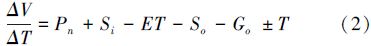
式中,ΔV/ΔT是单位时间内水量变化,Gi 和Go分别是地下水流入量和流出量,ET 是年蒸腾量,T 是潮汐流入量(+)或流出量(-)。根据北京区位特征和水文特征,潮汐对湿地的影响值取为0;由于缺乏地下水相关资料数据,对湿地影响忽略。考虑到北京城市用水对湿地的影响较大,在水文平衡方程因子中增加城市用水量UW。单位时间ΔT 设定为1a。因而,北京湿地的水文平衡方程表示为:

如果Pn,Si,E,So,和UW等水文因子记作为HFk (k=1,2,3,4,5),水文因子变化就可表示为ΔHFk,引起湿地退化的水文驱动因子贡献率CR计算模型表示为:

其正负取决于水文驱动因子在公式(3)中是输入(+)还是输出(-),及其变化趋势是增加(+)还是减少(-),两个符号的乘积即可表达出贡献率正负。
3 结果与讨论 3.1 湿地面积变化2 007年和1991年拥有明水体的湿地总面积分别为19380.44 hm2和25655.75 hm2,2007年湿地面积减少了约6275.31 hm2,为1991年湿地总面积的24.45%,空间分布如图 2所示。可以看出,野鸭湖湿地和密云水库湿地面积显著的减少,分别减少约1377.69 hm2和4654.50 hm2。北运河流域、蓟运河流域南部和潮白河流域南部湿地变化频率较高,且空间分布较为分散、不集中。
3.2 驱动因子总体变化特征及其贡献率 3.2.1 驱动因子总体变化特征如表 1所示,2007年与1991年相比,北京湿地的水文条件发生了很大变化。从变化率来看,地表水入境流量变化幅度最大,为73.13%;净降水量变化幅度最小,为23.82%。从绝对变化量来看,净降水量变化值最大,为26.21×10⁸ m3;地表水出境量变化值最小,为8.52×10⁸ m3。
| 地表水入境流量 Surface water inflows /(108 m3) | 净降水量 Net precipitation /(108 m3) | 蒸发量 Evaporation /(108 m3) | 地表水出境流量 Surface water outflows /(108 m3) | 城市供水量 Urban water supply /(108 m3) | |
| 1991年 | 12.84 | 110.04 | 41.64 | 15.94 | 20.38 |
| 2007年 | 3.45 | 83.83 | 29.71 | 7.42 | 5.67 |
| |ΔHFk| | 9.39 | 26.21 | 11.93 | 8.52 | 14.71 |
| % | 73.13 | 23.82 | 28.65 | 53.45 | 72.18 |
降水和入境地表水几乎是北京湿地的唯一补给水源,其变化是导致湿地变化的最主要自然类驱动因子。特别是净降水量占地表水资源总量的91%,它是北京湿地维持和变化的最主要因子。如图 3所示,1991年至2007年之间降水量和地表水入境量呈现出递减的趋势。相比之下,降水量递减趋势更为显著,地表水入境量随着时间的递减趋势更为明显。在此期间,只有1991年、1994年、1996年和1998年的降水量大于多年均值。1999年至2003年为持续干旱年,平均降雨量仅有427.80 mm,比多年均值少198.20 mm。从表 1可以看出,与1991年相比,2007年降水量少了156 mm,大约为26.21×10⁸ m3的水量。由于受上游区域的降水量、水资源利用等自然和人为因素的影响,与1991年相比较,2007年地表水入境水量减少了9.39×10⁸ m3。

|
| 图 3 1991—2007年净降水量、地表水入境量、蒸发量和地表水出境量统计特征 Fig. 3 Change of evaporation,surface water inflows,net precipitation and surface water outflows from 1991 to 2007 |
根据净降水量和地表水入境流量变化值,通过公式(3)和式(4)可以计算得到两个驱动力因子对湿地变化的贡献率分别为39.22% 和14.05%。从湿地退化的角度来看,两者均是正贡献。相反,从湿地维持的角度,两者都是负贡献。
3.2.3 蒸发量和地表水出境量变化特征及其贡献率水文方程中蒸发和出境地表水为两个主要水文输出因子,反映了自然条件变化对湿地变化的驱动效应。如图 3所示,1991年至2007年蒸发强度和地表水出境量都呈现出递减的趋势。相比之下,出境地表水量降低的变化趋势更为显著,随着时间递减的变化趋势更为明显。与1991年相比,2007年蒸发强度有微弱的增加。综合考虑到2007年湿地面积变小的因素后,蒸发量在2007年比1991年少了约11.93×10⁸ m3。与1991年相比,2007年地表水出境量较少了约8.52×10⁸ m3。根据公式(3)和式(4)分析,蒸发强度的增加对于湿地维持呈现出负贡献,贡献率为11.85%。地表水出境量的减少有利于湿地的维持,表现为正贡献,贡献率为12.75%。
3.2.4 城市用水量变化特征及其贡献率湿地作为城市发展的重要基础资源,为人类提供供给、调节、文化、支撑等许多生态服务,支撑城市发展。湿地提供服务与城市发展索取服务的互动过程,也是城市发展对湿地生态的干扰和胁迫过程。城市社会经济发展、人口扩张、科技进步等多种人为因素均影响着城市用水的变化,从而间接影响对湿地的胁迫作用。因此,人为胁迫过程主要为城市扩张和科技进步两个因素,城市扩张包括社会经济发展和人口扩张。
如图 4所示,与1991年相比,2007年地表水总供水量减少约14.71×10⁸m3。图 4和表 2可以看出,1991—2007年之间,生产用水量和生活用水量都呈现出下降趋势,尤其以生产用水量下降趋势更为显著。与1991年相比,GDP和人口总数增加,但是生产用水总量和生活用水总量都呈现明显减少,可能主要是科技进步使得产业转型和节水措施等而形成的。如果以2007年单位GDP用水量和人均用水量为参照标准,则2007年社会经济发展和人口扩张而引发的城市用水量仅增加了2.78×10⁸m3和0.87×10⁸m3。进而得到,科技进步为节约生产用水和生活用水水量分别为16.59×10⁸m3 和1.84×10⁸m3。根据公式(3)和(4),可以计算得到城市扩张和科技进步对湿地退化呈现出正贡献和负贡献,分别为3.42%和 25.55%。即,城市扩张对湿地生态构成胁迫,而科技进步有利于湿地维持和保育。

|
| 图 4 1991—2007年地表水供水总量、生产用水量和生活用水量统计特征 Fig. 4 Change of water supply,producing water and living water from 1991 to 2007 |
| 统计指标 Statistic indexes | 1991年 | 2007年 | 变化量Change | |
| 生产用水 | GDP/(1012元) | 598.90 | 9353.30 | 8754.40 |
| Producing water | 生产用水总量Total volume of producing water/ (108 m3) | 16.780 | 2.960 | -13.82 |
| 万元GDP用水量 Water per ten thousands GDP/m3 | 0.0280 | 0.0003 | -0.0277 | |
| 生活用水 | 人口数量 Population/104 | 1094.00 | 1633.00 | 539.00 |
| Living water | 生活用水总量Total volume of living water/(108 m3 ) | 3.60 | 2.62 | -0.98 |
| 人均用水量 Living water per capita/m3 | 32.91 | 16.04 | -16.86 |
以北京城市湿地为案例,基于卫星遥感数据提取了1991年和2007年湿地面积,利用湿地水文方程方法基于水量平衡分析了各湿地退化驱动因子的贡献率。结果表明:
(1)与1991年相比,2007年北京湿地较少约6275.31 hm2,约占1991年湿地总面积的24.46%。显著退化区域主要发生在野鸭湖湿地和密云水库湿地,分别减少了约1377.69 hm2和4654.50 hm2。北运河流域、蓟运河流域南部和潮白河流域南部湿地变化频率较高,且较为分散、不集中。
(2)湿地退化自然驱动因子以降水减少、入境地表水减少和蒸发量增加为主,贡献率分别为39.22%、14.05%和11.85%。人为驱动因子以城市扩展为主,贡献率为3.42%,而技术进步所采取的节水措施等有利于湿地保护,贡献率为25.55%。
致谢: 北京市林业勘察设计院王金增老师提供部分北京湿地基础资料,特此致谢。
| [1] | Mitsch W J, Gosselink J G. Wetlands(third edition). New York, NY, USA: John Wiley & Sons, Inc., 2000. |
| [2] | Millennium Ecosystem Assessment Board. Ecosystem Services and Human Well-being: Wetlands and Water Synthesis. Washington, DC, USA: World Resources Institute, 2005. |
| [3] | Paula F H, William K. Mlchener. Detecting wetland change: a rule-based approach using NWI and SPOT-XS data. Photogrammetric Engineering & Remote Sensing, 2000, 66:205-211. |
| [4] | Prigent C, Matthews E, Aires F. Rossow W B. Remote sensing of global wetland dynamics with multiple satellite sets. Geophysical Research Letters, 2001, 28: 4631-4634. |
| [5] | Eric M N, Stephen D. Prince and Gregory T. Koeln. Wetland change mapping for the U.S. mid-Atlantic region using an outlier detection technique. Remote Sensing of Environment, 2008, 112: 4061-4074. |
| [6] | Munyati C. Wetland change detection on the Kafue Flats, Zambia, by classification of a multi-temporal remote sensing image dataset. International Journal of Remote Sensing, 2000, 21:1787-1806. |
| [7] | Corey B, Rick L Lawrence, Clifford Montagne and Duncan Patten. Change detection of wetland ecosystems using Landsat imagery and change vector analysis. Wetlands 27:610-619, 2007. |
| [8] | Sader S A, Ahl D, Liou W S. Accuracy of Landsat-TM and GIS rule-based methods for forest wetland classification in Maine. Remote Sensing of Environment, 1995, 53:133-144. |
| [9] | Kindscher K, Fraser A, Jakubauskas M E, Debinski D M. Identifying wetland meadows in Grand Teton National Park using remote sensing and average wetland values. Wetlands Ecology and Management, 1998, 5: 265-273. |
| [10] | Townsend P A, Walsh S J. Remote sensing of forested wetlands: application of multitemporal and multispectral satellite imagery to determine plant community composition and structure in southeastern USA. Plant Ecology, 2001, 157: 129-149. |
| [11] | Ramsey E W, Rangoonwala A, Nelson G, Ehrlich R. Mapping the invasive species, Chinese tallow, with EO1 satellite Hyperion hyperspectral image data and relating tallow occurrences to a classified Landsat Thematic Mapper land cover map. International Journal of Remote Sensing, 2005, 26: 1637-1657. |
| [12] | Ringrose S A, Jellema P, Huntsman-Mapila, Barker L, Brubaker K. Use of remotely sensed data in the analysis of soil-vegetation changes along a drying gradient peripheral to the Okavango Delta, Botswana. International Journal of Remote Sensing, 2005, 26: 4293-4319. |
| [13] | Zalidis G C, Mantzavelas A L, Gourvelou E. Environmental impacts on Greek wetlands. Wetlands, 1997, 17:339-345. |
| [14] | Mironga J M. Degradation of wetland ecosystems: A case study of Kisii District, western Kenya. Biodiversity, 2006, 7: 3-16. |
| [15] | Jiang W, Wang W, Chen Y. Quantifying driving forces of urban wetlands change in Beijing. City Journal of Geographical Sciences 22(2): 301-314, 2012. |
| [16] | Beijing Gardening and Greening Bureau, Census report of Beijing wetlands, 2009. |
| [17] | Beijing Forestry Survey and Design Institute, Technology rules for Beijing wetlands survey, 2007. |
| [18] | McFeeters S K. The Use of Normalized Difference Water Index(NDWI) in the Delineation of Open Water Features. International Journal of Remote Sensing, 1996. 17 : 1425-1432. |
| [16] | 北京市园林绿化局, 北京市湿地普查报告, 2009. |
| [17] | 北京市林业勘察设计院, 北京市湿地资源普查操作技术细则, 2007. |