 2014, Vol. 34
文章信息
- 张华, 张兰, 赵传燕
- ZHANG Hua, ZHANG Lan, ZHAO Chuanyan
- 极端干旱区尾闾湖生态需水估算——以东居延海为例
- Ecological water requirement estimation of the rump lake in an extreme arid region of East Juyanhai
- 生态学报, 2014, 34(8): 2102-2108
- Acta Ecologica Sinica, 2014, 34(8): 2102-2108
- http://dx.doi.org/10.5846/stxb201306171720
-
文章历史
- 收稿日期:2013-6-17
- 修订日期:2013-11-22


The results were as follows: in January to March each year, the lake area in East Juyanhai remained unchanged. In April, the lake area began to decrease. The lake area reached a minimum in July, and the lake area gradually increased in August. After October, the lake area remained stable. The evaporation water consumption of East Juyanhai was highest from May to August, and maximum evaporation was in June. The average annual evaporation of water consumption under the guarantee rates of 50%, 75%, 95% was 1.7910×10⁸ m3, 1.6072×10⁸ m3, and 1.0373×10⁸ m3, respectively. The leakage of East Juyanhai was reasonably low; the average annual leakage under the guarantee rates of 50%, 75%, 95% was 15.0788×10⁴ m3, 13.5314×10⁴ m3, and 8.7334×10⁴ m3, respectively. Precipitation was mainly concentrated in June to October, and the average annual precipitation recharge under the guarantee rates of 50%, 75%, 95% was 118.1083×10⁴ m3, 105.9882×10⁴ m3, 68.4062×10⁴ m3, respectively. The average annual ecological water requirement of East Juyanhai under the guarantee rates of 50%, 75%, 95% was 1.7807×10⁸ m3, 1.5980×10⁸ m3, and 1.0314×10⁸ m3, respectively; accounted for about 9.66%, 8.66, and 5.59%, respectively, of the average annual runoff of Yingluoxia; about 16.27%, 14.60%, and 9.42%, respectively, of the average annual runoff of Zhengyixia; and about 30.81%, 27.65%, 17.84%, respectively, of the average annual runoff of Langxinshan.
The results showed that: under the minimum guaranteed rate, to maintain the East Juyanhai lake area (23.94 km2), prevent the lake from shrinking, and ensure the surrounding environment is not severely degraded, the minimum ecological water requirement is 1.03×10⁸ m3; under the appropriate guaranteed rate, to maintain the East Juyanhai lake area (37.09 km2) and initially improve the surrounding ecological environment, the minimum ecological water requirement is 1.60×10⁸ m3; under the ideal guaranteed rate, to maintain the East Juyanhai lake area (41.33 km2) and ensure that the surrounding ecological environment is greatly improved, the minimum ecological water requirement is 1.78×10⁸ m3.
This research can provide the basis for rational allocation of Heihe River Basin's water resources. According to the results on ecological water requirements at different guarantee rates, management schedules for East Juyanhai's water resources must account for the relative proportions of upper, middle and lower runoff to ensure the rational allocation of water resources in the Heihe River Basin. The results of the study are also a valuable reference for the restoration and reconstruction of East Juyanhai's surrounding vegetation.
湖泊是陆地上重要的水体,主要通过入湖河川径流、湖面降水和地下水而获得水量,具有生态系统良性循环、改善局部气候、抑制沙尘暴和维护生物多样性等多种功能。近年来,人类对湖泊资源的超载开采和不合理利用而导致湖泊不断干枯、萎缩和水质污染,从而造成湖泊周边植被退化、生物多样性减少、土地沙漠化等生态环境问题。因此,迫切需要研究湖泊生态需水,协调人类与湖泊资源的关系,以实现水资源科学配置和持续利用。
国外学者较早意识到保障湖泊生态需水的重要性,并对许多湖泊进行了研究。David等认为,湖泊水量必须保持在一定范围内,才能保证湖泊生态系统结构和功能的健康[1]。Abbaspour等以伊朗的乌尔米耶湖为例,通过确定生态、水质和水量3个环境变量指标,研究了湖泊生态需水量[2]。Wharton通过建立数值模型,对维持珊顿公园Jualbup湖一定水位的需水量进行了预测[3]。墨累-达令流域管理局对巴望达令河上游麦宁迪湖的环境需水进行评估,以应对新的环境问题和实施环境调水方案[4]。目前国内学者对湖泊生态需水的研究包括乌梁素海[5, 6]、卧龙湖[7]、南四湖[8]、洞庭湖[9]、红碱淖湖[10]、鄱阳湖[11]、乌古伦湖[12]、艾比湖[13]等。这些研究大多集中在湿润半湿润地区,干旱区内陆河尾闾湖生态需水研究较少。
黑河下游为生态需水研究的热点区域,已有的研究集中在以植被类型或生态系统类型为单元估算蒸散量,进一步计算整个区域的生态需水[14, 15, 16]。东居延海作为黑河下游重要的水资源库,其水量的多寡对维系下游的生态系统的良性循环,遏制沙尘暴,改善盐碱化和荒漠化具有重要作用,但尚未有学者对其生态需水进行研究。目前,国内外对湖泊生态需水的概念、内涵还没有形成统一的定义。本文估算的东居延海生态需水是指维持东居延海适宜的水域面积,防止湖泊萎缩和严重退化,保护和恢复周边区域生态环境所必需消耗的水量,主要是湖泊水面蒸发和湖泊渗漏。本研究能为实现黑河流域水资源合理配置和维持东居延海湖泊生态功能提供依据,为制定流域生态恢复方案提供科学参考。
1 研究区概况黑河在狼心山分为东西两河,分别注入尾闾湖东居延海(苏古淖尔)、西居延海(噶顺淖尔)和天鹅湖等。本文研究区为东居延海,经纬度位置42°10′—42°20′ N,101°12′—101°19′ E,行政区划上隶属于内蒙古自治区额济纳旗(图 1),位于巴丹吉林沙漠西北边缘。终年受蒙古气团控制,属温带大陆性极端干旱气候。光热充足、蒸发量大、降水稀少。根据额济纳旗气象站 1961—2011 年气象资料,多年平均气温 8.9 ℃,极端最高气温 40.6 ℃,极端最低气温-35.3 ℃,日温差一般为14—17 ℃,最高达 34 ℃。多年平均降水量35.1 mm,年内降水量60—70%集中在7—9月,多年平均蒸发量3317.1 mm。

|
| 图1 东居延海地理位置示意图 Fig. 1 The geographical position of East Juyanhai |
东居延海是额济纳绿洲生态系统最重要的支撑点,1927—1932年中瑞考察队测量水域面积在30 km2以上,北部最大水深4.12 m,1958年航片测算水域面积为35.5 km2[17]。但自20世纪60年代以来,由于黑河中游地区耗水量增加,补给下游额济纳旗的黑河水量不断减少,造成下游绿洲荒漠化迅速发展,生态环境急剧退化,最终导致1992年东居延海彻底干涸。2000年开始对黑河流域进行水资源统一调度,2002年,经过调度的黑河水到达东居延海,水域面积最大达到23.5 km2。到2012年,由ETM影像获得的东居延海水域面积最高达到55.96 km2,已经连续8年不干涸,周边生态环境得到较大改善。
2 数据与模型 2.1 数据遥感数据为2002—2012年各月的Landsat 7 ETM+影像,来源为美国地质勘查局(United Stated Geological Survey,USGS),轨道号为133—31,影像云量小于30%,该数据具有较好的时间连续性。先对遥感影像进行简单几何校正与配准预处理,采用目视解译法提取湖泊多边形面域,利用ArcGIS 9.3对其进行投影,再计算出湖泊面积。2003年5月31日以后,获取的数据由于Landsat 7 ETM+机载扫描行校正器(SLC)故障有条带,本文利用文献18的方法对数据条带进行修复,修复后的影像误差小,精度高[18]。
气象数据采用距东居延海最近的额济纳旗气象站2002—2012年各月平均风速、相对湿度、气温、水汽压、降水量,来源于中国气象科学数据共享服务网(http://cdc.cma.gov.cn)。因湖内平均风速比陆地约大2—3 m/s,湖内静风率比陆地约少一半以上,所以湖面风速采用气象站风速加3的处理方法,即W = W′+3W′ 为地面平均风速(m/s)[19]。
莺落峡是黑河上游与中游的界限,正义峡是中游与下游的界限,黑河在狼心山分为东河与西河,这几个水文站点是黑河干流的控制性站点。因此采用莺落峡、正义峡和狼心山2002—2012年径流量数据分析其与东居延海生态需水的关系。该数据来源于黑河流域管理局。
2.2 生态需水估算模型东居延海属于尾闾湖,根据水量平衡原理,其生态需水量应保证补充湖泊水面蒸散的耗水量和湖泊渗漏需水量,故东居延海生态需水量等于水面蒸发耗水量、湖泊渗漏量与降水补给量之差,计算式如下:

式中,V(t)为t时段内湖泊生态需水量(m3);E(t)为t时段内湖泊水面蒸发耗水量(m3);Q(t)为t时段内湖泊渗漏需水量(m3);P(t)为t时段内湖泊降水补给量(m3)。
2.2.1 湖泊面积运用月保证率设定法计算不同保证率下湖泊面积。
首先,将ETM影像解译获得的东居延海2002—2012年各月湖面面积,按照由大到小的顺序排列;其次,对湖面面积进行分组,确定组数、组距和各组的频数,计算各组的频率;然后,根据湖泊结构和功能选择适宜的保证率(50%、75%、95%);最后,计算不同保证率下对应的月及多年平均情况下的各月湖泊面积[20]。
2.2.2 湖面蒸发耗水量水面蒸发量计算式如下:
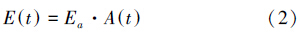
式中,Ea为单位面积水面蒸发量(mm/d);A(t)为t时段内湖泊的面积(m2)。
其中,Ea是运用李万义建立的水面蒸发量计算模型来确定,模型如下[21]:
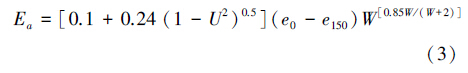
式中,e0为水面饱和水汽压(hpa);e150为水面上空1.5 m处水汽压(hpa);W为水面以上1.5 m处风速(m/s);U为相对湿度,以小数计。
饱和水汽压e0可按马格努斯(Magnus) 经验式计算[20]:


式中,e0水为气温为t时对应的水面饱和水汽压(hpa);e0冰为气温为t时对应的冰面饱和水汽压(hpa)。
将式(4)或(5)代入(3)式,得到水面蒸发计算模型的具体表达式如下:
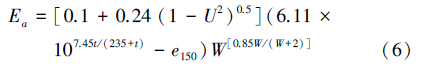
或
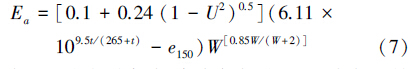
东居延海冬季寒冷,湖水每年从11月中旬开始结冰,1月形成稳定的冰盖,次年3月中旬出现浮冰。因此,1月、2月和12月采用式(5)计算饱和水汽压,其他月份采用式(4)计算饱和水汽压。所以,3—11月的湖泊水面蒸发量用式(6)进行计算,12—翌年2月的湖泊水面蒸发量用式(7)进行计算。
2.2.3 渗漏量湖泊渗漏需水量为湖泊的渗漏系数与湖泊面积乘积[22],其表达式为:
式中, k为隔水岩层(亚粘土层)渗漏系数,经验值为0.01(mm/d)[23]。
2.2.4 降水补给量
式中, p为单位面积降水量(m)。
3 东居延海生态需水估算 3.1 不同保证率下湖面面积计算湖泊面积保证率是指在某一时段内,湖面面积大于或小于某一界限的频率的总和,用于说明该种状况出现的可靠程度。图 2为ETM影像解译获得的东居延海2002—2012年各月湖面实际面积,选择50%为理想保证率,75%为适宜保证率,95%为最小保证率[24],按2.2.1方法计算出保证率分别为50%、75%、95%的各月湖面面积(表 1)。

|
| 图2 东居延海2002—2012年各月湖面实际面积 Fig. 2 The actual surface area of each month from 2002 to 2012 of East Juyanhai |
依据气象数据,由式(3)—(6)或(7)计算出东居延海2002—2012年各月月均蒸发量,再由式(2)得到不同保证率的各月月均蒸发量(图 3)。

|
| 图3 东居延海2002—2012年各月月均蒸发量和不同保证率的各月月均蒸发耗水量 Fig. 3 The average monthly evaporation from 2002 to 2012 and the evaporation water consumption under different guarantee rates of East JuYanHai |
因东居延海是浅水湖泊,湖底面积可近似地等于湖面面积,由表 1和式(8)得到东居延海在不同保证率下月均、年均渗漏量(表 2)。
|
保保证率/%
Guarantee rates | 面积 Area /km2 | ||||||||||||
| 1月Jan | 2月Feb | 3月Mar | 4月Apr | 5月May | 6月Jun | 7月Jul | 8月Aug | 9月Sep | 10月Oct | 11月Nov | 12月Dec | 全年Annual | |
| 50 | 44.1127 | 44.5336 | 44.6669 | 43.1829 | 40.2870 | 36.4798 | 32.2325 | 34.7256 | 37.5723 | 45.7825 | 46.8811 | 45.5597 | 41.3347 |
| 75 | 39.5859 | 39.9636 | 40.0832 | 38.7515 | 36.1529 | 32.7363 | 28.9248 | 31.1622 | 33.7167 | 41.0844 | 42.0703 | 40.8845 | 37.0930 |
| 95 | 25.5493 | 25.7931 | 25.8703 | 25.0107 | 23.3335 | 21.1285 | 18.6685 | 20.1125 | 21.7612 | 26.5164 | 27.1527 | 26.3874 | 23.9403 |
|
保保证率/%
Guarantee rates | 渗漏量 Leakage /104 m3 | ||||||||||||
| 1月Jan | 2月Feb | 3月Mar | 4月Apr | 5月May | 6月Jun | 7月Jul | 8月Aug | 9月Sep | 10月Oct | 11月Nov | 12月Dec | 全年Annual | |
| 50 | 1.3675 | 1.2469 | 1.3847 | 1.2955 | 1.2489 | 1.0944 | 0.9992 | 1.0765 | 1.1272 | 1.4193 | 1.4064 | 1.4124 | 15.0788 |
| 75 | 1.2272 | 1.1190 | 1.2426 | 1.1625 | 1.1207 | 0.9821 | 0.8967 | 0.9660 | 1.0115 | 1.2736 | 1.2621 | 1.2674 | 13.5314 |
| 95 | 0.7920 | 0.7222 | 0.8020 | 0.7503 | 0.7233 | 0.6339 | 0.5787 | 0.6235 | 0.6528 | 0.8220 | 0.8146 | 0.8180 | 8.7334 |
利用额济纳旗气象站观测的月降水量计算出2002—2012年各月月均降水量和年均降水量,再由式(9)计算出东居延海在不同保证率下降水补给量(表 3)。
|
保保证率/%
Guarantee rates | 降水量Precipitation /104 m3 | ||||||||||||
| 1月Jan | 2月Feb | 3月Mar | 4月Apr | 5月May | 6月Jun | 7月Jul | 8月Aug | 9月Sep | 10月Oct | 11月Nov | 12月Dec | 全年Annual | |
| 50 | 2.2858 | 0.5668 | 3.3703 | 4.3968 | 8.4969 | 18.0078 | 19.4567 | 20.5828 | 16.4635 | 20.6854 | 0.9376 | 2.8578 | 118.1083 |
| 75 | 2.0513 | 0.5086 | 3.0245 | 3.9456 | 7.6250 | 16.1599 | 17.4601 | 18.4707 | 14.7741 | 18.5627 | 0.8414 | 2.5646 | 105.9882 |
| 95 | 1.3239 | 0.3283 | 1.9520 | 2.5465 | 4.9213 | 10.4298 | 11.2690 | 11.9212 | 9.5354 | 11.9806 | 0.5431 | 1.6552 | 68.4062 |
将保证率为50%、75%、95%的蒸发耗水量、渗漏量、降水补给量代入(1)式中,得到东居延海不同保证率的各月月均和年均生态需水量(表 4)。
|
保保证率/%
Guarantee rates | 生态需水量 Ecological water requirement /108 m3 | ||||||||||||
| 1月Jan | 2月Feb | 3月Mar | 4月Apr | 5月May | 6月Jun | 7月Jul | 8月Aug | 9月Sep | 10月Oct | 11月Nov | 12月Dec | 全年Annual | |
| 50 | 0.0111 | 0.0316 | 0.0847 | 0.1744 | 0.2687 | 0.3157 | 0.3015 | 0.2636 | 0.1566 | 0.1085 | 0.0492 | 0.0152 | 1.7807 |
| 75 | 0.0099 | 0.0283 | 0.0760 | 0.1565 | 0.2412 | 0.2833 | 0.2706 | 0.2366 | 0.1405 | 0.0973 | 0.0441 | 0.0136 | 1.5980 |
| 95 | 0.0064 | 0.0183 | 0.0491 | 0.1010 | 0.1556 | 0.1828 | 0.1746 | 0.1527 | 0.0907 | 0.0628 | 0.0285 | 0.0088 | 1.0314 |
东居延海自2002年7月恢复水域以来,虽然有两次干涸,但湖面面积总体在不断扩大(图 2)。东居延海地区蒸发强烈,年均湖面蒸发耗水量大(图 3),在保证率为 50%、75%、95%下的年均蒸发耗水量分别为1.79×10⁸、1.61×10⁸、1.04×10⁸ m3,年均渗漏量分别为 15.08×10⁴、13.53×10⁴、8.73×10⁴ m3(表 2),年均降水补给量分别为118.11×10⁴、105.99×10⁴、68.41×10⁴ m3(表 3),年均生态需水量分别为1.78×10⁸、1.60×10⁸、1.03×10⁸ m3(表 4)。

|
| 图4 东居延海年均生态需水量与各水文站年径流量的百分比 Fig. 4 The annual ecological water requirement of East Juyanhai with percentages of the annual runoff of each hydrological station |
根据莺落峡、正义峡、狼心山年径流资料,得到各水文站2002—2012年年均径流量分别为18.44×10⁸、10.95×10⁸、5.78×10⁸ m3。东居延海在保证率为 50%、75%、95% 下的年均生态需水量分别约占莺落峡年均径流量的9.66%、8.66%、5.59%,约占正义峡年均径流量的16.27%、14.60%、9.42%,约占狼心山年均径流量的30.81%、27.65%、17.84%(图 4)。
生态需水量估算结果表明:在最小保证率95%下,维持东居延海23.94 km2的湖泊面积,使湖泊不再萎缩,周边生态环境不严重退化的最小生态需水量为1.03×10⁸ m3;在适宜保证率75%下,维持东居延海37.09 km2的湖泊面积,使其周边生态环境得到初步改善的生态需水量为1.60×10⁸ m3;在理想保证率50%下,维持东居延海41.33 km2的湖泊面积,使其周边生态环境得到较大改善的生态需水量为1.78×10⁸ m3。黑河径流量对东居延海及额济纳绿洲有直接的影响,东居延海及其周边生态环境对黑河径流量存在依赖关系。因此,在不同时期,应根据东居延海生态需水量占黑河流域上、中、下游径流量的比例合理分配水资源。
本文利用遥感技术目视解译ETM影像提取东居延海2002—2012年各月湖面面积,通过水文保证率法确定不同保证率下的湖面面积,结合额济纳旗气象站观测的气象数据计算湖泊蒸发耗水量和降水补给量,根据湖泊渗漏系数估算湖泊渗漏量,并运用水平衡原理构建湖泊生态需水模型,对东居延海的生态需水量进行了初步估算。能够为实现黑河流域水资源的科学管理、合理配置和持续利用提供科学依据,对恢复和重建东居延海周边植被具有一定的参考价值。
| [1] | Tilley D R, Badrinarayanan H, Rosati R, Son J. Constructed wetlands as recirculation filters in large-scale shrinp aquaculture. Aquacultural Engineering, 2002, 26(2): 81-109. |
| [2] | Abbaspour M, Nazaridoust A. Determination of environmental water requirements of Lake Urmia, Iran: an ecological approach. International Journal of Environmental Studies, 2007, 64(2): 161-169. |
| [3] | Rockwater Pty Ltd. Water Requirements for Maintaining Level of Lake Jualbup. Western Australia: Rockwater Pty Ltd, 2005. |
| [4] | MDBA (Murray-Darling Basin Authority). Assessment of the environmental water requirements for the Barwon-Darling River upstream of Menindee Lakes. Canberra: Murray-Darling Basin Authority, 2012. |
| [5] | Wang X K, Zhao T Q, Ouyang Z Y, Fan X Y. Researches on ecological water demand of Wuliangsuhai Lake. Acta Ecologica Sinica, 2004, 24(10): 2124-2129. |
| [6] | Wang Y M, Li W Q, Chang J X, Wan F, Huang Q. Study on ecological filling water volume of Wuliangsuhai Lake. Journal of Northwest A and F University, 2011, 39(8): 224-228. |
| [7] | Wang T L, Yang P Q, Zhou L F, Zhou L L. The research on minimum ecological water requiremen for Wolong Lake in Liaoning province. Research of Soil and Water Conservation, 2008, 15(6): 191-193. |
| [8] | Xu Z X, Wang H, Dong Z C, Tang K W. Minimum ecological water requirement for Nansi Lakes. Journal of Hydraulic Engineering, 2006, 37(7): 784-788. |
| [9] | Xie Y H, Li F, Chen X S. Study on the minimum ecological water demand for the Dongting Lake. Resources and Environment in the Yangtze Basin, 2012, 21(1): 64-70. |
| [10] | Tang K W, Wang H, Liu C. Preliminary study of Hongjiannao Lake's variation and ecological water demand. Journal of Natural Resources, 2003, 18(3): 304-309. |
| [11] | Liu H Y, Wang Y W, Guan X Z. Research on suitable ecological water level in Poyang Lake wetland: a case study in Xingzi Hydrological Station. Journal of Nanchang Institute of Technology, 2012, 31(3): 46-50. |
| [12] | Liang L L, Wang F, Wang D X, Wang H. Research on the lowest ecological water level and ecological water quantity of Ulungur Lake. Advances in Water Science, 2011, 22(4): 470-478. |
| [13] | Liu Y Q, Wang X F, Wu Y. Study on the lowest ecological water level of Aiby Lake. Journal of Arid Land Resource and Environment, 2008, 22(10): 111-114. |
| [14] | Wang G X, Zhang Y, Liu G M, Cheng Y F, Hu H C. Water demand evaluation of riverside ecosystem in arid inland river basin: the case of Heihe River Basin. Acta Ecologica Sinica, 2005, 25(10): 2467-2476. |
| [15] | Zhao W Z, Chang X L, He Z B, Zhang Z H. Research of the vegetation ecological water requirement of Egina oasis. Science In China Ser. D Earth Sciences, 2006, 36(6): 559-566. |
| [16] | Jia Y H. Study on the Spatial Distribution of Ecological Water Requirement in the Groundwater-fluctuating Belt of the Lower Reaches of Heihe River[D]. Journal of Lanzhou University, 2008: 18-32. |
| [17] | Chen L, Yang E, Li L, Bao H Z. The ecological function and value of East Juyanhai wetland. The People of Yellow River, 2011, 33(2): 84-85. |
| [18] | Qian L X, Li S F, Cui H S, Zhang Y L. Image quality evaluation of Landsat 7 ETM SLC-OFF based on a single image local regression model retrieved. Geography and Geo-Information Science, 2012, 28(5): 21-24. |
| [19] | Yang P, Cao S K, Meng C H, Wang C Y. Calculation of Qinghai Lake evaporation. Journal of Qinghai Normal University: Natural Science Edition, 2010, 26(3): 75-79. |
| [20] | Cui B S, Zhao X, Yang Z F. Eco-hydrology-based calculation of the minimum ecological water requirement for lakes. Acta Ecologica Sinica, 2005, 25(7): 1788-1795. |
| [21] | Li W Y. A study on the generalized model of water surface evaporation. Journal of Hydrology, 2000, 20(4): 13-17. |
| [22] | Liu J L, Yang Z F. A study on the calculation methods of the minimum eco-environmental water demand for lakes. Journal of Natural Resources, 2002, 17(5): 604-609. |
| [23] | Qiao M Y, Sun L, Guo Y C, Wang Q, Zhang H L. A study on groundwater deficit problems and countermeasures of Egina basin. Inner Mongolia Water Resources, 2005, (1): 12-15. |
| [24] | Li Y. Calculation of minimum ecological water requirement of Yangzong Lake. Yangtze River, 2010, 41(9): 32-34. |
| [5] | 王效科, 赵同谦, 欧阳志云, 范秀英. 乌梁素海保护的生态需水量评估. 生态学报, 2004, 24(10): 2124-2129. |
| [6] | 王义民, 李五勤, 畅建霞, 万芳, 黄强. 乌梁素海生态补水量研究. 西北农林科技大学学报, 2011, 39(8): 224-228. |
| [7] | 王铁良, 杨培奇, 周林飞, 周林林. 辽宁省卧龙湖最小生态需水的研究. 水土保持研究, 2008, 15(6): 191-193. |
| [8] | 徐志侠, 王浩, 董增川, 唐克旺. 南四湖湖区最小生态需水研究. 水利学报, 2006, 37(7): 784-788. |
| [9] | 谢永宏, 李峰, 陈心胜. 洞庭湖最小生态需水量研究. 长江流域资源与环境, 2012, 21(1): 64-70. |
| [10] | 唐克旺, 王浩, 刘畅. 陕北红碱淖湖泊变化和生态需水初步研究. 自然资源学报, 2003, 18(3): 304-309. |
| [11] | 刘慧英, 王永文, 关兴中. 鄱阳湖湿地适宜生态需水位研究—以星子站水位为例. 南昌工程学院学报, 2012, 31(3): 46-50. |
| [12] | 梁犁丽, 王芳, 汪党献, 王浩. 乌伦古湖最低生态水位及生态缺水量. 水科学进展, 2011, 22(4): 470-478. |
| [13] | 刘永泉, 王晓峰, 吴颜. 艾比湖最低生态水位研究. 干旱区资源与环境, 2008, 22(10): 111-114. |
| [14] | 王根绪, 张钰, 刘桂民, 程雨菲, 胡宏昌. 干旱内陆流域河道外生态需水量评价——以黑河流域为例. 生态学报, 2005, 25(10): 2467-2476. |
| [15] | 赵文智, 常学礼, 何志斌, 张智慧. 额济纳荒漠绿洲植被生态需水量研究. 中国科学D 辑(地球科学), 2006, 36(6): 559 -566. |
| [16] | 贾艳红. 黑河下游地下水波动带生态需水量空间分布研究 [D]. 兰州: 兰州大学, 2008: 18-32. |
| [17] | 陈丽, 杨二, 李莉, 鲍宏喆. 东居延海湿地生态功能与价值. 人民黄河, 2011, 33(2): 84-85. |
| [18] | 钱乐祥, 李仕峰, 崔海山, 张妤琳. 基于单一影像局部回归模型修复的Landsat 7 ETM SLC-OFF图像质量评价. 地理与地理信息科学, 2012, 28(5): 21-24. |
| [19] | 杨萍, 曹生奎, 孟彩虹, 王翠云. 青海湖水面蒸发量计算. 青海师范大学学报: 自然科学版, 2010, 26(3): 75-79. |
| [20] | 崔保山, 赵翔, 杨志峰. 基于生态水文学原理的湖泊最小生态需水计算. 生态学报, 2005, 25(7): 1788 -1795. |
| [21] | 李万义. 适用于全国范围的水面蒸发量计算模型的研究. 水文, 2000, 20(4): 13-17. |
| [22] | 刘静玲, 杨志峰. 湖泊生态环境需水量计算方法研究. 自然资源学报, 2002, 17(5): 604-609. |
| [23] | 乔茂云, 孙林, 郭雨春, 王庆, 张惠兰. 额济纳盆地地下水亏缺问题及其对策探讨. 内蒙古水利, 2005, (1): 12-15. |
| [24] | 李英. 云南阳宗海最小生态需水水量分析. 人民长江, 2010, 41(9): 32-34. |