 2014, Vol. 34
文章信息
- 林勇, 刘述锡, 关道明, 张振冬, 温泉
- LIN Yong, LIU Shuxi, GUAN Daoming, ZHANG Zhendong, WEN Quan
- 基于GIS的虾夷扇贝养殖适宜性综合评价——以北黄海大小长山岛为例
- GIS-based Japanese scallop (Patinopecten yessoensis) aquaculture suitability assessment:a case study with the islands of Dachangshan and Xiaochangshan, North Yellow Sea, China
- 生态学报, 2014, 34(20): 5984-5992
- Acta Ecologica Sinica, 2014, 34(20): 5984-5992
- http://dx.doi.org/10.5846/stxb201301250158
-
文章历史
- 收稿日期:2013-1-25
- 修订日期:2014-9-9
- 网络出版日期:2014-03-11


2. 国家海洋环境监测中心, 国家海洋局海域管理技术重点实验室, 大连 116023
2. Key Laboratory of Sea Areas Management Technology, National Marine Environmental Monitoring Center, State Oceanic Administration, Dalian, 116023, China
近年来随着野生贝类收获量不断下降,水产养殖成为贝类产品的重要来源[1]。然而由于缺乏科学空间规划养殖密度过大,贝类养殖的快速发展带来了环境退化、海域使用冲突和养殖贝类大量死亡等一系列问题[1, 2, 3]。为此,发展环境友好型的水产养殖业得到越来越多的重视[1]。根据水产养殖生物对自然-经济-社会环境因子的需求,确定适宜的海水养殖区将有助于提高水产养殖的效益和解决海域使用冲突和环境退化问题[1]。
养殖区选址是一个决策过程,需要大量具有空间属性的数据支持,GIS技术因而成为养殖区选址研究的一个重要工具[1, 2, 4, 5, 6]。自从1987年Kapetsky等[5]将GIS技术引入水产养殖研究以来,GIS在水产养殖中的应用日益增多,先后用于蚌、蟹、鱼、虾、褐藻、牡蛎等水产动植物养殖区适宜性评价[1]。就扇贝养殖而言,Radiarta和Saitoh等[1, 2]利用GIS模型对日本Funka湾的虾夷扇贝的养殖适宜性进行了空间分析,而Bacher等[7]用食物耗竭模型和GIS技术计算了中国桑沟湾栉孔扇贝的养殖容量。Michele 等[4]则对越南北部Halong湾群岛的海湾扇贝的养殖适宜性进行了研究。Liu等[8]利用GIS和遥感数据研究了大连海域虾夷扇贝的水产养殖适宜性以及气候变化对虾夷扇贝养殖的影响。尽管GIS已经应用于多种水产生物养殖适宜性评价中,GIS在这个领域的应用总体来说还很有限[6, 9],国内基于GIS的水产养殖适宜性评价方面做的工作更少[9]。杜宁等[9]曾经用GIS模型评估河南省内陆水产养殖适宜性,但其方法主要是借鉴陆地适宜性评价方法,对水产养殖生物的水体环境(包括生物、物理和化学环境)需求考虑不够充分。贾宝红等[10]的天津市淡水养殖适宜性评价研究也存在同样的问题。国内基于GIS模型的海水水产养殖适宜性评价的研究至今鲜有报导。
北黄海的长山群岛是中国虾夷扇贝主要养殖基地,其产量占全国产量的40%以上[11]。由于养殖缺乏科学规划盲目发展,长山群岛海域出现了养殖贝类大面积死亡和近岸海域污染加剧等问题[3],因此急需水产养殖空间格局优化的技术手段。本文以长山群岛的大小长山岛为例,根据虾夷扇贝对海洋生物、物理和社会经济环境需求,建立了水产养殖适宜性评价的GIS模型,对大小长山岛海域的虾夷扇贝养殖适宜性进行了综合评价。
1 研究方法 1.1 研究区域长山群岛处于中国辽东半岛东部,黄海北部海域,由142个岛、坨、礁组成。长山群岛陆域面积119 km2,海域面积7720 km2,属典型的温带季风气候。全年降水量640 mm,年平均气温10 ℃。长山群岛海域水深一般不足50 m,海水由北向南逐渐加深。海底绝大部分为软泥质,岛屿四周海底有岩礁、石砾和贝壳,个别海岛附近有沙质底。海水表面温度(SST)年平均11.5 ℃,极端最低水温-2.1 ℃,极端最高水温28.3 ℃。长山群岛旅游产业发达,是我国长江口以北唯一的群岛型休闲避暑胜地。
研究区位于北纬39°11.8′—39°18.4′,东经122°27.4′—122°48.4′,总面积约732 km2,其中海域面积680 km2。研究区内面积大于1.0 km2岛屿有大长山岛(26.69 km2)、小长山岛(18.66 km2)、哈仙岛(5.17 km2)、巴哨岛(2.22 km2)、塞里岛(1.72 km2)。大长山岛和小长山岛面积远远大于其它岛屿,因而在后文中将这一研究海域统称为大小长山岛海域。大小长山岛海域盛产海参、鲍鱼、扇贝等海珍品,并在小长山岛海域建有国家级海珍品自然保护区(图 1)。大长山岛海域和小长山岛海域在海洋生物和物理环境上还具有一定空间差异,如二者叶绿素a (Chl a)年平均浓度分别为1.09 mg/m3和0.89 mg/m3,海水透明度分别为4.0 m和6.4 m。盐度相差较大,大长山岛海域平均盐度为31.21,而小长山岛海域平均盐度为28.36。

|
| 图 1 北黄海大小长山岛海域的地理位置和海域使用 Fig. 1 Location and sea uses of the islands of Dachangshan and Xiaochangshan,North Yellow Sea |
影响水产养殖的因素很多,海水表面温度(SST)、透明度、Chl a浓度、水深、海水交换率、水流速度、底质类型、盐度、捕食者、病害生物以及社会-基础设施因素(如渔港、港口、道路、码头、市场、城镇等的便利性)是水产养殖区适宜性评价中常用指标[1, 6, 8, 12]。另外,评价单元与生态敏感区和生态重要区(如自然保护区和重要鱼类生境区)的距离也曾用于养殖区选址的研究中[12]。
根据研究海域的海域使用状况、存在的生态环境问题以及数据可获取性,采用Chl a浓度、SST、透明度、水深和评价单元(边长为250 m的正方形的像元)到渔港、城镇、旅游区和自然保护区的距离等指标对大小长山岛海域的虾夷扇贝养殖适宜性进行空间评价。前4个指标主要反映虾夷扇贝对海洋自然环境(海洋生物和物理环境)因子的需求(生物物理因素),而其它指标主要反映社会-基础设施、生物多样性保护以及旅游观光等因素对养殖区选址的影响(社会-生态因素),其中到保护区和旅游区距离两个指标反映了水产养殖影响生物多样性保护和降低旅游区质量(视觉污染)的问题。
指标确定后,通过资料收集和野外调查等方式获取相应的各种数据,构建地理信息数据库。具体数据来源如下:
(1)SST加州理工大学喷气动力实验室提供的空间分辨率为1 km的日SST水色遥感数据用于本文研究(http://ourocean.jpl.nasa.gov/SST),将所有没有质量问题的日SST数据平均,得到2009年的年平均SST数据,并重采样生成250 m空间分辨率的SST栅格数据。
(2)Chl a浓度、透明度和水深 Chl a浓度和透明度数据来自于2009—2010年度春季、夏季和冬季的3次野外调查(共20个站位),利用ArcGIS的空间分析模块,以大小长山岛的海岸线为障碍线,采用反距离权重法(IDW)对3次调查的Chl a浓度和透明度平均值进行空间插值,得到空间分辨率为250 m的Chl a浓度和透明度栅格数据。水深栅格数据则由研究海域内水深点数据(677个)通过同样方法插值获得。
(3)基础地理信息数据 城镇、渔港、航道、旅游区和自然保护区等地理信息数据来自于辽宁省海洋信息数据库。利用软件ArcGIS 10.0的欧氏距离工具计算评价单元到城镇、渔港、保护区和旅游区等距离指标,形成相应的空间分辨率为250 m栅格数据图层。
水色遥感的SST数据可靠性高,但基于水色遥感的透明度和Chl a浓度数据在近岸海域(二类水体)数据质量一般,与实测数据存在较大的误差,主要应用于大尺度海洋科学研究[13, 14]。由于研究区主要位于大小长山岛的近岸海域,面积较小并有实测Chl a浓度和透明度数据,本文研究所用的SST数据来自水色遥感,而Chl a浓度和透明度数据来自于实测数据,从而更好地保证数据的可靠性。由于海况原因没有采集到秋季Chl a浓度和透明度数据,考虑到本文的研究目的是对大小长山岛海域虾夷扇贝养殖适宜性的空间格局进行分析,而不是准确估算养殖适宜性指数,在春夏冬3个季节调查的Chl a浓度和透明度数据可以满足本研究对数据的要求。
1.2.2 指标打分和权重确定由于各个指标计量单位不同数值差异大,无法进行直接比较,因而需要将指标数据标准化处理。按照表 1的打分系统,对各指标栅格数据进行重分类,获得分值为1—8的标准化适宜性指数,其中8为最适宜,而1为最不适宜。权重确定则主要参考国外有关文献[1, 2, 8],并结合研究海域和虾夷扇贝生物学特点,通过咨询国内扇贝养殖专家和当地养殖户做适度修正确定。因为本文所用指标和文献中的指标体系基本一致,就没有自行确定权重。权重的确定方法可以分为主观法和客观法两大类。无论主观法(如层次分析法)还是客观法(熵权法和回归法)都存在一些问题,主观赋权法客观性较差,容易受人为主观因素的影响;客观赋权法可以减轻主观因素的影响但确定的权重缺少稳定性,不能充分体现指标本身的相对重要程度,有时与指标的实际重要程度相悖,解释性较差[10]。参考国外文献里的打分体系和权重值进行适当修正,能够更好地利用国外专家的知识和成果。
| 指标Criteria | 分值Score | 权重 | |||||||
| 1 | 2 | 3 | 4 | 5 | 6 | 7 | 8 | ||
| 海水表面温度/℃Sea surface temperature | 13.1—13.4 | 12.8—13.1 | 12.5—12.8 | 12.2—12.52 | 11.9—12.2 | 11.6—11.9 | 11.3—11.6 | 11.0—11.3 | 0.15 |
| 水深 Bathymetry/m | <5 | 5—7.5 | 7.5—10 | 10—12.5 | 12.5—15 | 15—17.5 | 17.5—20 | >20 | 0.06 |
| 透明度 Transparency/m | <1 | 1—1.5 | 1.5—2 | 2—2.5 | 2.5—3 | >4 | 3—3.5 | 3.5—4 | 0.09 |
| 叶绿素a浓度/(mg/m3)Chl a concentration | >4.5 | 4—4.5 | 3.5—4 | 3—3.5 | 0.9—1.5 | 1.5—2 | 2.5—3 | 2—2.5 | 0.4 |
| 保护区距离/km Distance to nature reserve | <3 | 3—4 | 4—5 | 5—6 | 6—7 | 7—8 | 8—9 | >9 | 0.1 |
| 渔港距离/km Distance to fishery harbor | >9 | 8—9 | 7—8 | 6—7 | 5—6 | 4—5 | 3—4 | <3 | 0.07 |
| 城镇距离/km Distance to town | >9 | 8—9 | 7—8 | 6—7 | 5—6 | 4—5 | 3—4 | <3 | 0.09 |
| 旅游区距离/km Distance to tourism spots | <1 | 1—2 | 2—3 | 3—4 | 4—5 | 5—6 | 6—7 | >7 | 0.04 |
在指标打分和权重确定的基础上,将海洋生物物理和社会-生态等指标得分进行线性加权求和,计算虾夷扇贝养殖适宜性综合指数(SSI),具体计算公式如下:
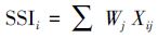
式中,SSIi为评价对象像元i的虾夷扇贝养殖适宜性指数,Wj为指标j的权重,而Xij为像元i指标j的得分(表 2)。
港口、城镇、航道区、自然保护区和旅游区由于生物多样性保护的需要和不能满足扇贝生境条件等空间制约原因,不能用于水产养殖,其扇贝养殖适宜性指数统一强行设置为0。
为分析空间制约因素对研究海域虾夷扇贝养殖适宜性的影响,扇贝养殖适宜性的空间分析在没有考虑空间制约因素和考虑空间制约因素两种情形下进行。在此基础上对大小长山岛海域的虾夷扇贝养殖空间格局调整和优化提出建议。
2 结果与分析 2.1 无空间制约情形下的扇贝养殖适宜性指数空间分布利用SST、透明度、水深、Chl a浓度以及到保护区、城镇、渔港和旅游区的距离等栅格数据,按照表 1的打分系统和权重进行运算,得到大小长山岛海域的虾夷扇贝养殖适宜性指数空间分布图(图 2)。大小长山岛海域虾夷扇贝养殖适宜性指数具有较大的空间变异,综合养殖适宜性指数在3.2到7.85之间,平均为5.28,说明大小长山岛海域是虾夷扇贝养殖的理想海域。大长山岛周边海域养殖适宜性指数明显高于小长山岛周边海域,适宜性指数高值区主要分布在大长山岛西部周边海域和东北海域。小长山岛西部海域由于渔业设施相对较少和自然保护区的存在,社会-生态适宜性指数明显低于其它海域,但由于这些因素的总体权重赋值较低(0.3),对大小长山岛海域综合养殖适宜性指数空间格局影响不大(图 2)。

|
| 图 2 不考虑空间制约情形下的大小长山岛海域虾夷扇贝养殖适宜性指数 Fig. 2 Site suitability index (SSI) of Japanese scallop aquaculture in the islands of Dachangshan and Xiaochangshan without consideration of spatial constraints |
为了更好地显示大小长山岛海域养殖适宜性空间分布格局,将养殖适宜性指数进行分级(表 2和图 3)。较高和高养殖适宜等级的海域面积分别为167.75 km2和44.06 km2,占整个研究海域的面积比例25.39%和6.67%。大部分海域养殖适宜性属于中等等级,研究区内没有低养殖适宜等级的海域。研究结果表明大长山岛相对于小长山岛而言,虾夷扇贝养殖适宜性更高,这与大长山岛海域浮游生物(扇贝的饵料)数量高于小长山岛海域报道一致[11]。
| SSI 等级SSI level | SSI 分值范围SSI score range | 面积 /km2Area | 比例/%Percentage | 面积/km2* Area | 比例/%*Percentage |
| 带有*的面积和比例是考虑空间制约因素后的面积和比例 | |||||
| 低 Low | <3.0 | 0 | 0 | 0 | 0 |
| 较低 Relatively low | 3.0—4.0 | 78.5 | 11.88 | 40.19 | 9.972 |
| 中等 Moderate | 4.0—6.0 | 370.38 | 56.06 | 232.19 | 57.615 |
| 较高 Relatively high | 6.0—7.0 | 167.75 | 25.39 | 111.00 | 27.559 |
| 高 High | 7.0—8.0 | 44.06 | 6.67 | 19.56 | 4.854 |

|
| 图 3 大小长山岛海域虾夷扇贝养殖适宜性等级空间分布图 Fig. 3 The suitability levels of Japanese scallop aquaculture in the islands of Dachangshan and Xiaochangshan in the scenario of no spatial constraints and that of spatial constraints |
海域使用冲突是海洋空间规划和海洋资源开发面临的主要问题。在大小长山岛海域,由于旅游区、自然保护区和航道区与水产养殖区存在海域使用冲 突,不能用于扇贝养殖,扇贝养殖适宜性指数强制设置为0。在本研究中,航道两侧750 m之内海域被设置为非养殖区。可以看出大长山岛西北海域较高和高养殖适宜性等级区在水产养殖和和航运用海之间存在明显海域使用冲突,导致长山群岛海域养殖适宜性明显下降(图 3,图 4)。

|
| 图 4 基于空间制约的大小长山岛海域虾夷扇贝养殖综合适宜性指数空间分布图 Fig. 4 Site suitability index (SSI) of Japanese scallop aquaculture in the islands of Dachangshan and Xiaochangshan with consideration of spatial constraints |
养殖密度过大是长山群岛海域扇贝养殖面临的主要问题,当地渔业管理部门虽然认识到调整养殖密度进行养殖空间格局优化的重要性,但如何调整和优化一直缺乏科学数据支持。虾夷扇贝养殖适宜性分析结果可以为大小长山岛海域扇贝养殖区选址和空间格局调整提供科学依据。由图 3和图 4可以看出,高和较高养殖适宜等级的海区主要分布在大长山岛周边海域,但由于水产养殖和航运存在海域使用冲突,高和较高养殖适宜性等级的海域区面积下降了近40%(表 2),航道调整无疑可以大幅度提高大小长山岛海域的虾夷扇贝养殖潜力。大小长山岛海域虾夷扇贝养殖适宜性指数具有较大的空间变异,小长山岛东部海域和南部海域养殖适宜性一般,养殖密度过大会导致扇贝大规模死亡,建议降低现有养殖密度,而大长山岛西部周边海域养殖适宜性指数大都在6.0以上,则可以适度提高养殖密度。在大小长山岛海域进行虾夷扇贝养殖区选址时,建议优先选择养殖适宜性指数在6.0以上的海域。虾夷扇贝养殖适宜性指数在7.0以上的海域仅有19.56 km2,但航道调整后可以提高到44.06 km2,在海域使用规划时建议将这些高养殖适宜等级的海域设置为虾夷扇贝养殖基本保护区。
3 讨论在本文中海洋生物物理因素的权重分别为0.7,而社会-生态因素的权重设置为0.3,这样处理既强调了海洋自然环境因素在虾夷扇贝养殖区选择中的重要地位,又考虑了其它因素(渔港设施,城镇劳力资源,航道)对虾夷扇贝养殖的影响,研究结果更具科学性和综合性。但是,这会带来渔港和自然保护区附近的海域水产养殖效益和计算的养殖适宜性指数不尽一致的问题。
虾夷扇贝养殖适宜性评价的对象是像元而不是行政区,研究结果可以为渔业管理部门提供研究区内任意一处海域的养殖适宜性指数,这将为大小长山岛海域虾夷扇贝水产养殖业的空间布局调整提供重要科学依据。扇贝养殖适宜性指数模型同时考虑了海洋因素和陆地因素(渔港、城镇等),体现了海陆统筹的思想。海陆统筹一直是海岸带管理的重要理念,但基于海陆统筹的定量实例研究一直鲜有报道。将陆地社会-基础设施对海水养殖的影响用简单的距离指标来反映的方法可为今后相关研究提供借鉴。另外,模型考虑了水产养殖对生物多样性保护和旅游的影响,体现了因地制宜选择评价指标的原则。
基于适宜性指数的养殖适宜性评价的关键在于科学确定指标打分系统和权重。日本学者在Funka湾做的研究工作虽然经典,但其各生物物理指标的打分体系同样存在着一定的随意性,许多指标在标准化成1—8的适宜性指数时,都采用了等间距分类法(equal interval)。考虑到扇贝生长和环境因子关系一般都是非线性的,这种处理显得不够科学。利用室内实验研究扇贝生长发育与环境因子的关系,确定SST、Chl a浓度和透明度等指标的扇贝养殖适宜性打分系统,将有助于改进这一问题。
4 结论大小长山岛海域虾夷扇贝养殖适宜性较高,且具有较大的空间变异,高养殖适宜等级区主要分布在大长山岛西北和西南海域,小长山岛海域养殖适宜性明显低于小长山岛海域。由于水产养殖和航运存在海域使用冲突,大小长山岛海域较高和高养殖适宜性等级的海域面积大幅下降。航道调整可以大幅提高大小长山岛海域的虾夷扇贝养殖潜力。虾夷扇贝养殖适宜性的空间分析结果可以为水产养殖区选址和养殖区的空间格局调整提供科学依据。
| [1] | Radiarta I N, Saitoh S I. Biophysical models for Japanese scallop, Mizuhopecten yessoensis, aquaculture site selection in Funka Bay, Hokkaido, Japan, using remotely sensed data and geographic information system. Aquaculture International, 2009, 17(5): 403-419. |
| [2] | Radiarta I N, Saitoh S I, Miyazono A. GIS-based multi-criteria evaluation models for identifying suitable sites for Japanese scallop (Mizuhopecten yessoensis) aquaculture in Funka Bay, southwestern Hokkaido, Japan. Aquaculture, 2008, 284(1): 127-135. |
| [3] | Yuan X T, Zhang M J, Liang Y B, Liu D, Guan D M. Self-pollutant loading from a suspension aquaculture system of Japanese scallop (Patinopecten yessoensis) in the Changhai sea area, Northern Yellow Sea of China. Aquaculture, 2010, 304(1/4): 79-87. |
| [4] | Michele M, Thuoc P, Canh N T, Khanh P T, Fausto M. Site suitability analysis for bay scallop aquaculture and implications for sustainable fisheries management in the ha long bay archipelago, northern Vietnam. Journal of Natural Resources and Development, 2013, 3: 1-13. |
| [5] | Kapetsky J M, McGregor L, Herbert Nanne E. A Geographical Information System and Satellite Remote Sensing to Plan for Aquaculture Development: A FAO-UNEP/GRID Cooperative Study in Costa Rica. Rome, Italy: FAO, 1987. |
| [6] | Pérez O M, Telfer T C, Ross L G. Geographical information systems-based models for offshore floating marine fish cage aquaculture site selection in Tenerife, Canary Islands. Aquaculture Research, 2005, 36(10): 946-961. |
| [7] | Bacher C, Grant J, Hawkins A J S, Fang J G, Zhu M Y, Besnard M. Modeling the effect of food depletion on scallop growth in Sungo Bay (China). Aquatic Living Resources, 2003, 16(1): 10-24. |
| [8] | Liu Y, Saitoh S I, Radiarta I N, Jirawake T. An impact of climate change on the development of marine aquaculture: a case study on the Japanese scallop in Dalian, China using satellite remote sensing and GIS-based models, The second international symposium, Effects of climate change on the world's oceans, Yeosu Korea, May, 2012. |
| [9] | Du N, Yang N S, Sun Y Z. GIS-based evaluation of aquaculture suitability in Henan Province. Journal of Fishery Sciences of China, 2008, 15(3): 476-482. |
| [10] | Jia B H, Ouyang H Y, Sun Y Z, Lv X J, Wang X R, Li F J. Evaluation on freshwater aquaculture suitability in Tianjin based on GIS. Tianjin Agricultural Sciences, 2012, 18(6): 64-68. |
| [11] | Zhang Y G, Wang C. Research on shellfish aquaculture in Changshan archipelage. Ocean Development and Management, 2008, 26(3): 117-123. |
| [12] | Silva C, Ferreira J G, Bricker S B, DelValls T A, Martín-Díaz M L, Yáez E. Site selection for shellfish aquaculture by means of GIS and farm-scale models, with an emphasis on data-poor environments. Aquaculture, 2011, 318(3/4): 444-457. |
| [13] | Ren J P, Zhao J P. Progress and prospect of ocean color remote sensing in case 2 waters. Advance in Earth Sciences, 2002, 17(3): 363-371. |
| [14] | Niu M X, Zhao X Y. Application of satellite remote sensing and GIS technology to the research of marine fishery resources. South China Fisheries Science, 2008, 4(3): 70-74. |
| [9] | 杜宁, 杨宁生, 孙英泽. 基于GIS 的池塘养殖适宜性评价——— 以河南省为例. 中国水产科学, 2008, 15(3): 476-482. |
| [10] | 贾宝红, 欧阳海鹰, 孙英泽, 吕雄杰, 王晓蓉, 李凤菊. 基于 GIS 的天津市淡水养殖适宜性评价. 天津农业科学, 2012, 18 (6): 64-68. |
| [11] | 张耀光, 王冲. 长山群岛海域发展扇贝养殖的研究. 海洋开发 与管理, 2008, 26(3): 117-123. |
| [13] | 任敬萍, 赵进平. 二类水体水色遥感的主要进展与发展前景. 地球科学进展, 2002, 17(3): 363-371. |
| [14] | 牛明香, 赵宪勇. 卫星遥感和GIS 技术在海洋渔业资源研究 中的应用. 南方水产, 2008, 4(3): 70-74. |