 2014, Vol. 34
文章信息
- 梁国付, 许立民, 丁圣彦
- LIANG Guofu, XU Limin, DING Shengyan
- 道路对林地景观连接度的影响——以巩义市为例
- Impacts of roads on woodland landscape connectivity:a case study of Gongyi City, Henan Province
- 生态学报, 2014, 34(16): 4775-4784
- Acta Ecologica Sinica, 2014, 34(16): 4775-4784
- http://dx.doi.org/10.5846/stxb201212261870
-
文章历史
- 收稿日期:2012-12-26
- 网络出版日期: 2014-3-4


2. 河南大学环境与规划学院, 开封475004
2. College of Environment and Planning, Henan University, Kaifeng 475004, China
景观连接度主要研究景观中同类斑块之间或异类斑块之间在功能和生态过程上的有机联系,即景观是促进或阻碍生物体或某种生态过程在斑块间运动的程度[1, 2, 3]。景观连接度包括结构连接度和功能连接度,单纯地考虑结构连接度,而不考虑生物体的扩散过程是没有生态学意义的。景观连接度对生态系统功能,如种子扩散、动物迁移、基因流动、以及干扰渗透和土壤的侵蚀等具有重要影响,进而直接关系到生态系统完整性、可持续性和稳定性。生物体的扩散能力对生物多样性保护具有重要意义,而生物体的成功扩散依赖于景观连接度的高低。景观的结构特征和生物体的行为特性共同决定了生物群体在景观中的连接度高低[4, 5]。研究表明,提高景观连接度可以有效地促进物种的扩散,可以增强生物在景观中的迁移、觅食、繁殖和生存能力,从而降低局域种群的灭绝风险[6, 7, 8, 9]。景观连接度一方面与物种的生物学特性有关,另一方面对研究对象的特征尺度有很强的依赖性。不同尺度上景观空间结构特征和生态学过程都有所不同,不同的物种对景观结构的反应依赖于物种对景观异质性感知的尺度和物种穿越基质的能力。因此,景观连接度的分析必须考虑不同的空间尺度和景观异质性特征。
道路是景观中的隔离性很强的线性基础设施,与土地利用变化密切相关[10],道路网络的发展可以促进社会的发展和经济的繁荣,但同时也会导致负面生态效应,如污染环境、侵占生境、降低生境质量、利于物种入侵和造成生境破碎等方面[11, 12, 13]。对景观的影响主要体现在道路的建设往往能促进景观的破碎化,使得景观连接度降低,特别是高等级公路的建设,甚至超过地形特征的影响[14]。哺乳动物对道路的影响非常敏感,道路往往阻止物种在道路两边的栖息地之间移动。
近年来,基于图论的景观连接度模型为景观连接度的分析提供了新的研究方法[15, 16, 17, 18]。该研究方法基于图论,把栖息地斑块划分为一系列的节点以及节点之间的相互连接,定量分析每一栖息地斑块对维持景观连接度的贡献程度,它不仅能描述栖息地斑块之间的结构连接度状况,而且综合考虑物种的扩散迁移能力和景观结构对物种的影响,即功能景观连接度状况。分析功能连接度时,一些研究依据节点间的欧式几何距离,借用景观连接度指数,分析斑块间的连接度[19, 20],或是基于生物体扩散能力的模拟[21],而这些研究多没有考虑景观基质异质性的影响;此外,还有研究通过利用最小距离耗费模型来确定基质异质性对物种扩散阻碍程度的高低,来分析栖息地斑块的功能连接度[22, 23, 24]。目前,国内研究者在道路对景观破碎化影响、评估及监测方面进行了一系列研究,特别是在云南纵向岭谷区和西双版纳林区[25, 26, 27],还有从国家尺度上评价道路对景观破碎化的影响格局[28]。而开展道路对林地景观连接度对的影响的研究还比较少。
巩义市位于中岳嵩山北麓,地貌类型多样。巩义市南高北低,山地、丘陵、平原类型齐全。近年来,该区域的土地利用发生了较大的变化,道路用地也迅速扩展。前期研究表明,基于景观连接度来分析在森林恢复时重要斑块的选取的方法对于该区森林景观恢复具有较强的指导意义。那么,在森林景观恢复时,道路对林地景观斑块连接度的影响如何?怎样定量评价道路对林地景观斑块连接度的影响?这些问题是林地景观恢复时急需要解决的问题。研究基于景观连接度原理,在综合考虑了不同景观土地利用阻力效果的基础上,依据有道路和没有道路两种情形,利用可能连通性指数、斑块重要值等对巩义市山区林地景观连接度进行了分析,探讨道路对林地景观连接度对的影响。
1 研究地区概况巩义市位于河南省西部,地理位置于北纬34°31′—34°52′和东经112°49′—113°17′之间,总面积1052 km2(图 1)。气候属暖温带大陆性季风气候,多年平均降水量为583 mm,年内降水多集中于7、8月和9月(占全年70%)。巩义市南依嵩山,地势由南向北逐渐降低,河川平原和丘陵地区以农业为主,或者是农林间作。低山区以经济林和人工林为主。基本的景观类型有林地(自然林、灌木林和人工林等)、水域、 农业用地(水浇地、旱地)、建设用地(居民点、工矿用地和交通用地)和荒草地等主要景观类型。巩义市道路系统发展迅速,公路密度达1.91 km/km2。

|
| 图 1 巩义市位置 Fig. 1 Location of the Gongyi City |
依据海拔高度的不同,将研究区地貌进行了分区(图 2),其中平原和河川地区海拔低于200 m,丘陵地区海拔为200—500 m,低山地区海拔为500—1000 m,中山地区海拔大于1000 m。研究中主要分析了海拔大于500 m的低山和中山地区林地景观的连接度特征及道路对林地景观连接度的影响,因为该区是林地景观分布的主要区域(图 2),物种丰富且保存良好,道路对动物栖息地的影响显得尤为重要。

|
| 图 2 巩义市地貌分区和研究区域 Fig. 2 Geomorphologic division of the Gongyi City and location of the study area |
本文的研究数据源:研究区的2010年1 ∶ 1万土地利用现状图,研究区1 ∶ 5万数字高程模型图(DEM),自然地理基础数据(包括地形地貌、土壤、水文和植被的基本资料)。采用Conefor Sensinode 2.2来计算各景观连接度指数[17],空间分析等采用ArcGIS 9.3和ArcView 3.2软件,最小耗费距离采用Pathmatrix 1.1软件计算[29](Pathmatrix 1.1是ArcView 3.2下的扩展模块,根据确定的阻力耗费面,计算物种从某一林地斑块边缘到其它所有林地斑块边缘的最小耗费距离)。
2.2 景观连接度指数的选取 2.2.1 景观累积耗费距离累积耗费距离,亦称代价距离,它不是空间上两个景观单元之间的实际距离,而是强调景观阻力在一定空间距离上的累积效应[30]。根据相关文献[31]、咨询专家和考虑研究区的实际情况,将区域不同景观类型的阻力大小设定为:林地为1、灌木林为5、草地为40、农业用地为60、滩地为60、河流(包括水体)为100、建设用地为1000。道路阻力值的大小因道路宽度的不同而不同。道路宽度为6—10 m的阻力值为800、10—15 m的阻力值为900、>15 m的阻力值为1000、高速公路阻力值为1200。此外,考虑到高度和坡度的影响,将高程为<600 m、600—700 m、700—800 m、800—900 m、900—1000 m和>1000m的区域,阻力值分别设为10、40、100、400、800和1200;将坡度为<8°、8—15°、15—25°、25—30 °、30—40 °和>40 °的区域,阻力值分别设为1、5、10、30、60和100。然后将3个阻力面进行叠加,形成分析用的阻力面。依此确定阻力面,在Pathmatrix 1.1软件中,求取物种从某一林地斑块边缘到其它所有林地斑块边缘的最小耗费距离。
2.2.2 可能连通性指数(PC)可能连通性指数(PC)的算式如下:

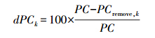
通过对可能连通性指数的计算,可以得知目前林地景观连接度的高低,为了分析每一林地景观斑块对林地景观整体连接度贡献程度的大小,选用斑块的重要值(dPCk)来衡量。计算方法如下:
为了分析每一林地斑块对林地景观整体连接度的贡献程度,即其重要性大小,对每一林地斑块的重要值的大小按照自然断点的方法从低到高分成5级,分别为:非常低、低、中等、高、非常高。
2.3 景观连接度变化的距离阈值选取景观连接度的计算需要确定林地景观斑块的阻力耗费距离阈值,当斑块间阻力耗费距离大于阈值时,认为斑块间不连通,当斑块间阻力耗费距离小于或等于阈值时,则认为是连通的。研究中将距离阈值d确定为0.5、1、2.5、5 km和10 km共5个不同的距离阈值,代表该区域哺乳动物平均扩散距离,在此5个距离阈值下分析道路对林地景观连接度的影响。
3 研究结果 3.1 林地景观连接度变化分析不论是在有道路还是在没有道路时,随着景观距离阈值的增大,林地景观整体可能连通性指数值(PC)都表现为逐渐增大(表 1)。当景观距离阈值从0.5、1、2.5、5 km增加到10 km时,有道路情况下,林地景观的PC值从最低值0.0365增加到0.0947;没有道路情况下,林地景观的PC值从最低值0.1941增加到0.2899,且在不同的距离阈值下,没有道路情况下林地景观的PC值都大于有道路情况下林地景观的PC值。
| 不同道路影响情景 Different road impact scenarios | 0.5 km | 1 km | 2.5 km | 5 km | 10 km |
| 有道路时With roads | 0.0365 | 0.0425 | 0.0587 | 0.0756 | 0.0947 |
| 没有道路时Without roads | 0.1941 | 0.2322 | 0.2672 | 0.2818 | 0.2899 |
为了确定每一林地斑块对林地景观整体连接度的贡献程度,即其重要性的高低,对每一林地斑块的重要值(dPCk)的大小按照自然断点的方法分成“非常低、低、中等、高、非常高”5级(表 2和图 3)。
| 距离阈值 /km Distance thresholds | 重要值非常高 dPCk very high | 重要值中等 dPCk medium | 重要值低 dPCk low | 重要值高 dPCk high | 重要值非常低 dPCk very low | |||||
| 斑块数量 Number of patches | 面积 Patch area /km2 | 斑块数量 Number of patches | 面积 Patch area /km2 | 斑块数量 Number of patches | 面积 Patch area /km2 | 斑块数量 Number of patches | 面积 Patch area /km2 | 斑块数量 Number of patches | 面积 Patch area /km2 | |
| 0.5 | 2 | 37.96 | 5 | 33.17 | 6 | 14.22 | 9 | 8.36 | 30 | 6.90 |
| 1 | 2 | 37.96 | 5 | 33.17 | 6 | 14.22 | 10 | 9.69 | 29 | 5.57 |
| 2.5 | 5 | 65.33 | 3 | 10.47 | 3 | 8.22 | 11 | 10.45 | 30 | 6.14 |
| 5 | 5 | 65.33 | 3 | 10.47 | 4 | 10.34 | 10 | 8.80 | 30 | 5.67 |
| 10 | 2 | 37.96 | 3 | 27.36 | 5 | 16.72 | 11 | 12.31 | 31 | 6.26 |
| 0.5 | 3 | 48.81 | 1 | 10.16 | 1 | 4.57 | 9 | 20.01 | 4 6 | 1 6.98 |
| 1 | 3 | 48.81 | 1 | 10.16 | 1 | 4.57 | 7 | 15.93 | 48 | 21.06 |
| 2.5 | 3 | 48.81 | 1 | 10.16 | 4 | 8.96 | 10 | 16.27 | 42 | 16.33 |
| 5 | 3 | 48.81 | 5 | 19.12 | 6 | 8.58 | 14 | 13.47 | 32 | 10.55 |
| 10 | 3 | 48.81 | 2 | 14.72 | 7 | 12.19 | 8 | 11.60 | 40 | 13.21 |

|
| 图 3 不同距离阈值下林地斑块重要值变化 Fig. 3 The dPCk values for woodland patches under different dispersal distance thresholds 左图为没有道路,右图为有道路 |
可以看出,在不同的距离阈值情况下,有道路和没有道路两种情况下,对林地景观连接度起“非常高”和“高”作用的林地斑块数量都比较少,最少为4块,最多为8块,大部分斑块对林地景观连接度所起的作用为“低”或“非常低”。
没有道路时,对林地景观连接度起“非常高”和“高”作用的斑块数量共8块(2.5、5 km),占林地总斑块数目的比例为15.38%,斑块总面积为75.80 km2,占林地总面积的比例为75.34%。对林地景观连接度起“低”或“非常低”作用的斑块数量共44块(2.5、5 km),占林地总斑块数目的比例为84.62%,斑块总面积为24.81 km2,占林地总面积的比例为24.66%。
有道路时,对林地景观连接度起“非常高”和“高”作用的斑块数量共8块(5 km),占林地总斑块数目的比例为13.33%,斑块总面积为63.53 km2,占林地总面积的比例为63.20%。对林地景观连接度起“低”或“非常低”作用的斑块数量共42块(5 km),占林地总斑块数目的比例为70.00%,斑块总面积为37.00 km2,占林地总面积的比例为36.80%。
3.3 道路对林地斑块重要值的影响为了进一步确定道路对林地景观斑块连接度的影响,选了A、B、C、D和E共5块道路从中间穿过的林地景观斑块(图 2和图 4),没有道路的情况是把现在的道路改为林地,通过分析有道路和没有道路两种情况下斑块重要值的变化,来确定道路对林地景观连接度的影响。

|
| 图 4 道路对林地斑块重要值影响 Fig. 4 Impacts of roads on woodland patches dPCk values 左图为没有道路,右图为有道路 |
由于道路的穿过,原来的一个大的林地斑块变成2个或更多各斑块,林地斑块数量增加。总体来看,在不同的景观距离阈值下,由于道路的通过,林地斑块分成多个斑块后,每一个林地斑块的重要值和原先相比都降低了。
没有道路时,A斑块在0.5、1、2.5、5 km和10 km不同的景观距离阈值下,重要值分别为22.8150、27.9676、26.0768、21.3209和17.2011。道路穿过后分成了两个斑块(A1和A2),不同的景观距离阈值下,A1林地斑块的重要值分别为0.5400、0.7458、1.8232、3.5060和5.4880,和原来A林地斑块的重要值相比,A1斑块的重要值分别减少了97.63%、97.33%、93.01%、83.56%和68.10%。A2斑块的重要值分别为2.0883、2.0710、2.8542、4.4881和6.6569,和原来A林地斑块的重要值相比,A2斑块的重要值分别减少了90.85%、92.60%、89.05%、78.95%和61.30%。
其它B、C、D、E和A斑块有相似的规律,分成多个林地斑块后,各斑块的重要值都比原来的重要值要小,减少最大的是99.80%(E3,距离阈值为0.5 km时),减少最低的是4.38%(B1,距离阈值为5 km时)。
B斑块(2.5、5 km和10 km距离阈值下)、C斑块(10 km距离阈值下)和D斑块(10 km距离阈值下),由于道路的穿过,分离成的多个斑块的重要值的总和都比原来一个大的林地斑块的重要值要大。如B斑块,在2.5、5 km和10 km距离阈值下,没有道路时,斑块的重要值分别为1.6064、1.5831和1.5712;有道路时,B1和B2重要值之和分别为2.0211、2.9155和3.0753,比原来一个大的林地斑块的重要值分别增加了25.82%、84.16%和95.73%。
4 结论和讨论景观连接度对与生态系统功能具有重要影响,直接关系到生态系统完整性、可持续性和稳定性。林地斑块是物种栖息的主要场所,是重要的生境资源斑块。景观中生境斑块资源的丰富度和分布对于物种的移动、觅食、避害等至关重要。但生物群体是否能从一个生境资源斑块到达另外一个生境资源斑块,在相当程度上取决于二者之间的景观连接度水平。道路是人造线形景观要素,往往造成景观破碎化,如阻碍动物自然迁移和活动、增加人类活动的影响、改变景观连接度、作为廊道提供迁移路径,进而影响种群、群落和生态系统在景观中的空间配置和动态变化。
基于图论分析方法的景观连接度研究,景观组分(或连通区域)是一组节点(nodes)或斑块(patches),每对节点或斑块之间通过一定的路径而相连接。不同的组分之间彼此孤立,一个独立节点(斑块)也可以成为一个独立的组分。景观组分越少,景观连接度越高。林地景观整体可能连通性的高低与景观距离阈值有很大相关关系,随着景观距离阈值由0.5、1、2.5、5 km增加到10 km,建立连通的林地景观斑块的搜索范围也逐渐增大,景观中任意两个斑块间的链接越容易建立,斑块之间的链接数也逐渐增加。当景观距离阈值再增大时,景观斑块组分数值最终减少到1,也即所有的林地景观斑块都成为连通性的斑块,景观中所有斑块能够互相连接,且属于同一个组分。
在此过程中,不论有没有道路,随着景观距离阈值的增大,林地景观整体可能连通性指数值(PC)都表现为逐渐增大。有道路时林地景观整体可能连通性指数值(PC)明显要比没有道路时的可能连通性指数值(PC)小。说明就所分析的区域来看,道路的确会影响到物种的扩散,增加物种迁移的阻力。由于道路的阻隔和分割作用,导致林地景观斑块之间建立连通性的困难程度增强。在不同的景观距离阈值下,有道路时林地景观整体连通性均比没有道路时降低了。就单一斑块而言,随景观距离阈值的增加和物种扩散能力的增强,道路分割成的多个斑块建立连接越容易,斑块的重要值降低程度在逐渐减少。
对林地景观连接度起“非常高”和“高”作用的林地斑块数量都比较少,但占林地总面积比例较大,表明面积大的林地斑块在提高景观连接度中起的作用较大。斑块重要值的计算,一方面与节点的位置有关系,另一方面也与斑块的面积的有关系,这与Urban等的研究相吻合[32],但重要值的大小与节点和面积之间的关系还需要深入研究。同时,道路对斑块重要值的影响明显,道路的穿过使得分成的多个林地斑块重要值降低。Gurrutxaga等研究表明[31],大尺度上,道路网络会使得自然保护区的整体连通性降低,而单个保护区对整体连通性的贡献程度降低,即重要值降低。
基于图论分析方法来分析道路对景观连接度的影响,生物体特性的分析往往很难针对每一具体的物种,在分析时采用对区域主要物种扩散能力进行分类,如论文所提到的采用不同的距离阈值(0.5、1、2.5、5 km和10 km)来代表物种扩散能力,显得比较机械和武断。随着距离阈值的增加,也即物种扩散能力和活动范围的增加,由于道路分割成的小斑块的重要值降低程度在逐渐减少,说明物种保护需要选择合适的尺度,同样的景观对不同的物种而言其连接度状况是不一样的,依据物种的扩散和迁移特性选择合适的尺度。
论文中道路对林地景观连接影响的分析方法,具有一定的可操作性与实用性,并非只用景观指数来描述景观格局状况。依据有道路和没有道路时林地景观连接度的变化,以及每一林地斑块重要值的变化,据此确定道路穿越某一林地斑块时对该斑块重要值影响程度大小的变化,对于区域生物多样性保护、森林生态系统功能的提高等研究实践具有指导意义。基于空间图论的景观连接度指数,为道路建设生态作用的评估提供了可操作性的、实用性的方法,尤其是针对扩散能力不同的物种。道路与景观连接度之间的关系复杂,在以后研究中还需要深入物种的扩散距离、景观的异质性、及每一林地斑块节点及相互之间的链接关系。高程的变化对景观的连通性(结构、功能)影响也需要深入。此外,道路一方面能阻碍某些物种迁徙、扩散,另一方面道路阻止某些疾病等具有传染性破坏源(例如风媒的疾病)的传播。且在一定条件下,道路较某些土地覆被类型来说(比如水体)可以促进某些物种的扩散。这些问题还需要在下一步研究中进一步加强。
| [1] | Taylor P D, Fahrig L, Henein K, Merriam G. Connectivity is a vital element of landscape structure. Oikos, 1993, 68(3): 571-573. |
| [2] | Chen L D, Fu B J. The ecological significance and application of landscape connectivity. Chinese Journal of Ecology, 1996, 15(4): 37-42. |
| [3] | Tischendorf L, Fahrig L. On the usage and measurement of landscape connectivity. Oikos, 2000, 90(1): 7-19. |
| [4] | With K A, Gardner R H, Turner M G. Landscape connectivity and population distributions in heterogeneous environments. Oikos, 1997, 78(1): 151-169. |
| [5] | Hamilton G S, Mather P B, Wilson J C. Habitat heterogeneity influences connectivity in a spatially structured pest population. Journal of Applied Ecology, 2006, 43(2): 219-226. |
| [6] | Uezu A, Metzger J P, Vielliard J M E. Effects of structural and functional connectivity and patch size on the abundance of seven Atlantic Forest bird species. Biological Conservation, 2005, 123(4): 507-519. |
| [7] | Awade M, Metzger J P. Using gap-crossing capacity to evaluate functional connectivity of two Atlantic rainforest birds and their response to fragmentation. Austral Ecology, 2008, 33(7): 863-871. |
| [8] | Verbeylen G, de Bruyn L, Adriaensen F, Matthysen E. Does matrix resistance influence red squirrel (Sciurus vulgaris L. 1758) distribution in an urban landscape?. Landscape Ecology, 2003, 18(8): 791-805. |
| [9] | Nell M C. Patch connectivity and genetic diversity conservation in the federally endangered and narrowly endemic plant species Astragalus albens (Fabaceae). Biological Conservation, 2008, 141(4): 938-955. |
| [10] | Patarasuk R, Binford M W. Longitudinal analysis of the road network development and land-cover change in Lop Buri province, Thailand, 1989—2006. Applied Geography, 2012, 32(2): 228-239. |
| [11] | Forman R T T. Estimate of the area affected ecologically by the road system in the United States. Conservation Biology, 2000, 14(1): 31-35. |
| [12] | Liu J N, Li W Q, Bao Z Y. Application of road network theory in studying ecological effects of landscape fragmentation: a case study with the road network of Zhejiang Province. Acta Ecologica Sinica, 2008, 28(9): 4352-4362. |
| [13] | McGarigal K, Romme W H, Crist M, Roworth E. Cumulative effects of roads and logging on landscape structure in the San Juan Mountains, Colorado (USA). Landscape Ecology, 2001, 16(4): 327-349. |
| [14] | Freitas S R, Hawbaker T J, Metzger J P. Effects of roads, topography, and land use on forest cover dynamics in the Brazilian Atlantic Forest. Forest Ecology and Management, 2010, 259(3): 410-417. |
| [15] | Saura S, Pascual-Hortal L. A new habitat availability index to integrate connectivity in landscape conservation planning: comparison with existing indices and application to a case study. Landscape and Urban Planning, 2007, 83(2/3): 91-103. |
| [16] | Saura S, Pascual-Hortal L. Conefor Sensinode 2. 2 User′s Manual: Software for Quantifying the Importance of Habitat Patches for Maintaining Landscape Connectivity Through Graphs and Habitat Availability Indices. Lleida Spain: University of Lleida, 2007. |
| [17] | Saura S, Torné J. Conefor Sensinode 2.2: a software package for quantifying the importance of habitat patches for landscape connectivity. Environmental Modelling & Software, 2009, 24(1): 135-139. |
| [18] | Saura S, Rubio L. A common currency for the different ways in which patches and links can contribute to habitat availability and connectivity in the landscape. Ecography, 2010, 33(3): 523-537. |
| [19] | García-Feced C, Saura S, Elena-Rosselló R. Improving landscape connectivity in forest districts: A two-stage process for prioritizing agricultural patches for reforestation. Forest Ecology and Management, 2011, 261(1): 154-161. |
| [20] | Neel M C. Patch connectivity and genetic diversity conservation in the federally endangered and narrowly endemic plant species Astragalms albens (Fabaceae). Biological Conservation, 2008, 141(4): 938-955. |
| [21] | Morzillo A T, Ferrari J R, Liu J G. An integration of habitat evaluation, individual based modeling, and graph theory for a potential black bear population recovery in southeastern Texas, USA. Landscape Ecology, 2011, 26(1): 69-81. |
| [22] | Gonzalez J R, del Barrio G, Duguy B. Assessing functional landscape connectivity for disturbance propagation on regional scales-A cost-surface model approach applied to surface fire spread. Ecological Modelling, 2008, 211(1/2): 121-141. |
| [23] | Saura S, Estreguil C, Mouton C, Rodríguez-Freire M. Network analysis to assess landscape connectivity trends: application to European forests (1990—2000). Ecological Indicators, 2011, 11(2): 407-416. |
| [24] | Watts K, Handley P. Developing a functional connectivity indicator to detect change in fragmented landscapes. Ecological Indicators, 2010, 10(2): 552-557. |
| [25] | Liu S L, Wen M X, Cui B S. Ecological effects of different road classes on landscape in the Lancang River valley. Geographical Research, 2007, 26(3): 485-490. |
| [26] | Fu W, Liu S L, Degloria S D, Dong S K, Beazley R. Characterizing the “fragmentation-barrier” effect of road networks on landscape connectivity: A case study in Xishuangbanna, Southwest China. Landscape and Urban Planning, 2010, 95(3): 122-129. |
| [27] | Liu S L, Deng L, Zhao Q H, de Gloria S D, Dong S K. Effects of road network on vegetation pattern in Xishuangbanna, Yunnan Province, Southwest China. Transportation Research Part D: Transport and Environment, 2011, 16(8): 591-594. |
| [28] | Li T A, Shilling F, Thorne J, Li F M, Schott H, Boynton R, Berry A M. Fragmentation of China′s landscape by roads and urban areas. Landscape Ecology, 2010, 25(6): 839-853. |
| [29] | Ray N. Pathmatrix: a geographical information system tool to compute effective distances among samples. Molecular Ecology Notes, 2005, 5(1): 177-180. |
| [30] | Yue D P, Wang J P, Liu Y B, Li H L, Xie H C, Wang D M. Landscape pattern optimization based on RS and GIS in northwest of Beijing. Acta Geographica Sinica, 2007, 62(11): 1244-1231. |
| [31] | Gurrutxaga M, Rubio L, Saura S. Key connectors in protected forest area networks and the impact of highways: A transnational case study from the Cantabrian Range to the Western Alps (SW Europe). Landscape and Urban Planning, 2011, 101(4): 310-320. |
| [32] | Urban D L, Minor E S, Treml E A, Schick R S. Graph models of habitat mosaics. Ecology Letters, 2009, 12(3): 260-273. |
| [2] | 陈利顶, 傅伯杰. 景观连接度的生态学意义及其应用. 生态学杂志, 1996, 15(4): 37-42. |
| [12] | 刘佳妮, 李伟强, 包志毅. 道路网络理论在景观破碎化效应研究中的运用——以浙江省公路网络为例. 生态学报, 2008, 28(9): 4352-4362. |
| [25] | 刘世梁, 温敏霞, 崔保山. 不同道路类型对澜沧江流域景观的生态影响. 地理研究, 2007, 26(3): 485-490. |
| [30] | 岳德鹏, 王计平, 刘永兵, 李海龙, 谢怀慈, 王冬梅. GIS与RS技术支持下的北京西北地区景观格局优化. 地理学报, 2007, 62(11): 1244-1231. |